

There is a particular kind of absurdity that only reveals itself at altitude.
You are standing on a high ridge somewhere in the backcountry. The view in front of you is extraordinary, a sweep of wilderness that took you four hours to reach, light falling across rock and tree in a way that feels designed for you alone. A hawk is circling somewhere above the ridge line. The air is clean enough to think clearly in.
And you are staring at your phone.
Not at the hawk. Not at the light. Not at the mountains. At a small blue dot on a screen, inching along a red line, confirming that yes, you are exactly where the algorithm says you should be.
This is the central paradox of modern intuitive trail finding: we have built tools of extraordinary navigational precision, and in doing so we have quietly weakened the very faculty that makes wilderness navigation possible in the first place. The hippocampus is the part of the brain that builds spatial memory through direct sensory experience—does not atrophy from disuse like an unused muscle. It becomes, in effect, dormant. The capacity remains. The practice does not.
The ancient Daoist text that sits at the center of QuietRoam’s philosophy, the Dao De Jing, has something to say about exactly this situation. In Chapter 28, Lao Tzu writes:
知其白,守其黑,为天下式。
Know the white, keep to the black—and become a pattern for the world.
In the mountains, the “white” is the visible, verified, quantifiable world of technology: GPS coordinates, elevation profiles, red-line routes, data you can screenshot and share. The “black” is everything else: the moss on a north-facing rock, the sound of water in a drainage, the way the temperature shifts as you move off a ridge and into a valley, the sense of direction that lives in your body before it ever reaches your conscious mind.
Mastery in the backcountry, Lao Tzu suggests, is the art of knowing both, the white and the black, and understanding which one to trust, and when.
This is the Daoist art of intuitive trail finding. And it begins with understanding what we have lost.
The Blue Dot Trap: How GPS Silences the Hippocampus
The neuroscience here is both fascinating and quietly alarming.
In 2000, neuroscientist Eleanor Maguire and her colleagues published a landmark study of London taxi drivers, people who had spent years navigating the capital by memory, without GPS. The result was unmistakable: the hippocampi of experienced taxi drivers were measurably larger than those of control subjects, and the size correlated with the number of years spent navigating by spatial memory. The study, published in PNAS, found that the hippocampal volume changes were related to the experience of learning and navigating London’s complex street network.
The inverse is equally true. Research published since the widespread adoption of smartphone GPS has documented a measurable reduction in hippocampal engagement when people rely on turn-by-turn navigation rather than building mental maps themselves. The brain is doing what brains do: it is allocating resources to the task at hand. When the task is “follow the arrow,” the hippocampus has nothing to work with.
In the backcountry, this matters enormously. The hippocampus is the organ through which you build a lived relationship with the landscape. Every ridge you cross on your own attention becomes a landmark in a mental map that persists long after the battery dies. Without it, the landscape is scenery. With it, the landscape is a map you carry inside you, and a map you can navigate when the screen goes dark.
This is what the QuietRoam philosophy calls the scattering of spirit. We first encountered the concept in the context of dehydration. It is a state of dispersed, thin awareness in which the mind captures every signal except the one it should be attending to. In navigation, the phenomenon is identical. The phone captures attention. The landscape passes by. You arrive at your destination knowing the coordinates but not the terrain.
A hiker in this state is not lost. But they are not truly found, either.
Know the White: The Technology You Should Know Cold
Before we venture into the unmapped territory of intuitive navigation, it is important to say clearly what the QuietRoam philosophy is not arguing.
We are not arguing against technology. We are not suggesting that a GPS device is a crutch for the weak, or that “real” hikers navigate by stars and moss. We are not performing a romantic rejection of the modern world from a ridge with cell service.
A GPS device, a quality offline maps application, a PLB or satellite communicator: these are not the enemy of sensory navigation. They are what we would call a backcountry safety net, and there is profound wisdom in relying on them where they matter. The philosophy is not asking you to throw your phone into a river. It is asking you to understand why you reach for it, and to distinguish the moment you are using a tool from the moment a tool is using you.
This is the know-the-white principle in practice: not the rejection of technology, but its correct assignment. Technology belongs in the background of a backcountry experience. It is a resource you consult when the situation demands it, not a lens through which the experience is continuously filtered.
For hikers who are still building their technical foundation, who have not yet developed the fluency with GPS and offline mapping that makes the conscious decision to put the screen away possible. The first step is to learn the technology thoroughly. A GPS device is not dangerous. GPS dependence is. And the difference between the two is the same as the difference between knowing a tool and being known by it.
Know the white. Deeply. Confidently. Then put it in your pack.
Keep to the Black: Four Primal Skills for Intuitive Navigation
This is where the philosophy becomes practice, where the abstract instruction to “keep to the black” resolves into specific, learnable, bodily skills that any hiker can begin to develop on their next trip.
The landscape itself is a yin-yang system, and learning to read it begins with understanding its fundamental binary.
Ridgelines are yang terrain: exposed, bright, wind-scoured, visually dominant. They rise above the surrounding landscape and can be identified from a distance. They hold heat during the day and release it quickly at night. They are the landscape’s skeleton, the most reliable visual landmarks, the easiest features to plot on a map from the air.
Valleys and drainages are yin terrain: sheltered, shadowed, moisture-collecting, acoustically alive with the sound of moving water. They carry the landscape’s lifeblood. Water flows downhill, and if you learn to follow its voice, you learn to move toward the low ground where trails converge, camps form, and shelter can be found.
The practice of intuitive navigation begins with lifting your eyes from the screen and asking: am I on yang terrain or yin terrain right now? Where is the nearest ridge? Where is the nearest drainage? The answers to those two questions place you, approximately but reliably, on the landscape.
1. Reading Topography as Yin and Yang
When you approach any stretch of trail from the philosophical perspective of intuitive trail finding, the first thing you notice is that the ground is not flat, and it is not random. Every slope has an aspect. Every ridge has an opposite valley. The relationship between them is legible if you give your attention the space to settle.
Stand still at a trailside bench and spend a minute simply observing the terrain around you. Which way does the wind come from? Where does the shadow fall across the distant ridgeline as the afternoon progresses? If you could see the whole valley from above, where would a trail most likely run? Asking those questions is itself the practice. The answers come slowly, then all at once, and then they are permanent.
2. The Language of Flora: Plants as Living Maps
This is perhaps the most undervalued navigational skill in modern hiking, and it is also one of the most immediately practical.
Plants do not grow randomly. They grow in response to specific conditions: light, moisture, wind exposure, soil composition, temperature, and those conditions correspond precisely to the terrain features that matter for navigation. A forest is, in a real sense, a map drawn in living material. You just have to learn the handwriting.
Moss and lichen accumulate preferentially on the north-facing surfaces of rocks and tree trunks in the Northern Hemisphere, the yin side, the shaded side, the side that retains moisture. This is not an exact compass. Moss is affected by microclimate, aspect, and species variation in ways that make it unreliable at a single rock. But at a valley scale, where an entire stand of trees and a stretch of north-facing rock all point the same way, the signal becomes unmistakable.
Tree canopy asymmetry is a subtler but equally reliable indicator. In regions with consistent prevailing winds, which in most of North America means predominantly westerly flow, and trees on exposed terrain grow with their canopy pushed and shaped toward the leeward side. You are looking at the direction the wind has been coming from for decades. That is navigational information, and it is painted on every tree.
Vegetation density and species composition shift predictably with aspect and elevation. Dense, dark coniferous forest typically indicates north-facing slopes with good moisture retention, yin terrain. Open, sun-tolerant species with sparse undergrowth indicate south-facing exposure, wind, and dry soil—yang terrain. The transition between them marks a line on the landscape you could plot.
When you begin to read plants as navigational information rather than scenic backdrop, the wilderness gains a new layer of legibility. The forest becomes a kind of handwritten map, annotated by the terrain itself. A hiker who has spent years on the same mountain range, who has watched the same stand of trees change through spring, summer, and the slow decay of autumn, develops a kind of navigational literacy that no map can replicate. The individual trees are no longer just trees. They are markers, and they are placed by the terrain in ways that make sense to someone who has paid attention long enough to notice the pattern. This is what happens when the practice becomes habit: the landscape stops being scenery and becomes a text.
For the hiker new to the practice, the starting point is simple: stop, look up, and ask one question. Which way is the moss growing? Where does the tree canopy lean? What is the light doing on the ridgeline as the sun moves through the afternoon? A single question, asked honestly, is enough to begin. The hippocampus will do the rest if you give it the material to work with.
3. Micro-Climate Cadence: Wind, Water Sound, and the Skin as Compass
This is the practice of backcountry navigation: in The Earth as a Book, we explored the 200,000 sensory nerve endings in the human foot, and what becomes possible when we trust them to read the ground. The skin of the face and hands is equally sensitive, and equally underutilized. The nervous system is designed to pick up environmental signals at a level of resolution that exceeds anything a screen can display. We simply do not practice attending to them.
Wind direction is one of the most immediately useful signals available to the intuitive navigator. Mountain wind patterns are not random. They follow predictable cycles tied to temperature differentials between valley and ridge. During the day, anabatic winds flow uphill as the sun warms the rock. At night, katabatic winds flow downhill as cooled air pools and slides into the valley. The National Weather Service describes these valley-to-ridge wind systems as anabatic and katabatic currents, standard meteorological phenomena tied to the daily thermal cycle. Knowing which phase of the daily cycle you are in tells you, with reasonable precision, which way is up and which way is down.
Water sound is directional information that most hikers filter out entirely. Running water almost always flows toward lower ground, and lower ground is where trails converge, where valleys open, and where shelter can be found. When the trail goes quiet, listen for water. It is the most reliable signal in the landscape that something, such as a trail, camp, river crossing—is waiting in the direction the sound is coming from.
Temperature gradients can be felt on the face with surprising precision. Cold air pools in drainages and low-lying terrain, a yin accumulation. Warm air rises to ridges and exposed saddles. Moving through a temperature change on your face is, in effect, crossing an invisible line on the map, and your body can detect it before your conscious mind names it.
These are not mystical perceptions. They are physiological responses to real environmental signals, responses that the hippocampus is designed to integrate into spatial awareness, if we give it the input.
4. Mental Mapping: Anchor Points Over Live Tracking
This is the most direct practice for rebuilding the hippocampal engagement that GPS dependence has quieted, and it is also the most immediately transformative.
The practice is simple: turn off live tracking. Not permanently, not as a survival experiment, but as a deliberate perceptual exercise. Keep the GPS in your pocket as your safety net. It is your safety net. But while you are walking, do not check it.
Instead, as you move through the terrain, actively identify and mentally register anchor points: distinctive natural features that you could locate reliably on a map and that serve as fixed reference markers in your mental model of the landscape. A distinctive rock formation. The point where the trail crosses a stream. The bend where the forest gives way to alpine meadow. The saddle between two peaks, visible on the horizon.
Each anchor point you register is a node in the mental map you are actively constructing, a map that lives in your hippocampus rather than on your screen, and that therefore can be navigated in three dimensions, in memory, without any input from a device. When the anchor points start connecting into a coherent model of the landscape, you have begun to do what your ancestors did: navigate by mental reconstruction, not by signal reception.
This is exactly the navigational system your ancestors used, refined over hundreds of thousands of years of movement through complex terrain. It is dormant. It wakes up quickly when given the conditions to work.
Every time you choose to register an anchor point rather than glance at the screen, you are doing something your nervous system has been built to do since long before the first GPS satellite was launched. The practice feels like a small thing at first—a pause at a trailside rock, a moment of lifting your eyes to read the ridgeline, a deliberate effort to notice which way the wind is coming from. But the small things compound. After a season of practicing, the mental map you carry is no longer an approximation of the screen. It is something older, and something that works when the screen is dead. It wakes up quickly when given the conditions to work.
The Junction Practice: Dynamic Harmony at the Crossroads
There is a specific moment in every off-trail or complex backcountry hike where intuitive navigation is most tested, and most valuable. It is the unmarked junction: the point where the maintained trail gives way to ambiguous terrain, where two or more possible paths offer themselves with roughly equal plausibility, and where the instinctive response is to reach for the screen and confirm.
This is the moment when most hikers reflexively reach for the phone. And it is exactly the moment to pause instead.
Reminiscent of the “Pre-Source Pause” we practice when approaching wild water, the Junction Practice is its navigational equivalent. The principle is the same: stop, open your attention, and let the landscape tell you the answer before you consult an external signal.
When you arrive at an uncertain junction, stop. Do not reach for the phone. Stand still for sixty seconds, a duration that feels much longer than it is, and simply observe:
- Water sound: which branch has water moving along it, or closer to it? Water flows toward lower ground. Lower ground is usually where the route you want is heading.
- Soil compression and vegetation disturbance: which path shows more evidence of use? Compressed soil, disturbed leaf litter, broken twigs—these are the marks of prior passage.
- Canopy and light: which direction does the terrain open? Where is the light coming from in the afternoon? A southwest-facing opening in the afternoon suggests the ridge line.
- Your own body: which direction feels right? This is not mysticism. After hours of moving through terrain with your senses open, your body develops a subtle sense of orientation—a felt direction that the hippocampus has already integrated before the conscious mind has words for it.
After sixty seconds of observation, make a decision. If the decision turns out to be wrong, if you have walked a hundred meters down the wrong branch and the terrain is clearly diverging from your intention — turn around. No shame, no alarm. A wrong turn of a hundred meters is information. Information is the material you work with in the dynamic, responsive negotiation between your intention and the terrain’s reality. The GPS device in your pocket is not useless — it is the insurance policy you bought and are now choosing not to open. Best Backcountry GPS Devices takes that idea seriously: five devices evaluated not on screen size, but on which one you can trust to stay in your pocket all day.
This is dynamic harmony in practice: not the perfection of the route, but the capacity to keep adjusting, to keep listening, to keep correcting, without ever outsourcing the act of attending to a screen.
When the Screen Goes Dark, the World Comes Alive
There is a particular kind of clarity that arrives when you put the phone away in earnest, not as a performance of unplugging, but as a genuine transfer of navigational trust to your own body and senses. It is not a state you achieve once and then own. It is a state you return to, hike after hike, as your attention becomes more disciplined and your confidence grows.
The second skin of your base layer is managing the yin-yang of heat and moisture against your skin. The water within you, kept clean and fluid, sustains the clarity of your awareness. Your feet, reading the ground through the 200,000 nerve endings in each sole, tell you which way the slope is running, where the ground is solid and where it is loose, where the trail is firm and where it has washed out. The moss tells you where north is. The tree canopy tells you where the wind comes from. The sound of water tells you where the valley floor lies. The shadow falling across that distant ridgeline tells you the hour.
You are navigating because the screen is absent, not in spite of it. The screen was never the problem. It was the dependency on it, the outsourcing of perception that happens when the screen becomes the primary lens through which the landscape is experienced.
Know the white, keep to the black: know the technology completely. Then keep to the unmapped, unscreened, irreducibly alive world of sensory experience. Let the device be the safety net you never need to use. Let the landscape be the map you carry inside you.
This is the highest expression of the principle that great skill looks like clumsiness. The navigator who moves with quiet assurance through complex terrain, with no visible device, no anxious stops to check coordinates, no visible signs of navigation at all, appears, to the uninitiated, to simply know where they are going. They do not look like experts. They look like they have always lived here.
Put the phone in your pocket. Raise your eyes. Let the trail show itself.
This is intuitive trail finding. This is knowing the white, keeping to the black. This is the QuietRoam way.
From Chapter 28 of the Dao De Jing: 知其白,守其黑,为天下式 — Know the white, keep to the black, and become a pattern for the world.
From Chapter 45: 大巧若拙 — Great skill looks like clumsiness.
神散 — The scattering of spirit: the state of dispersed, thin awareness in which attention is captured by the screen and the landscape passes by.
Integrating Your Navigation Practice Into the Whole Gear System
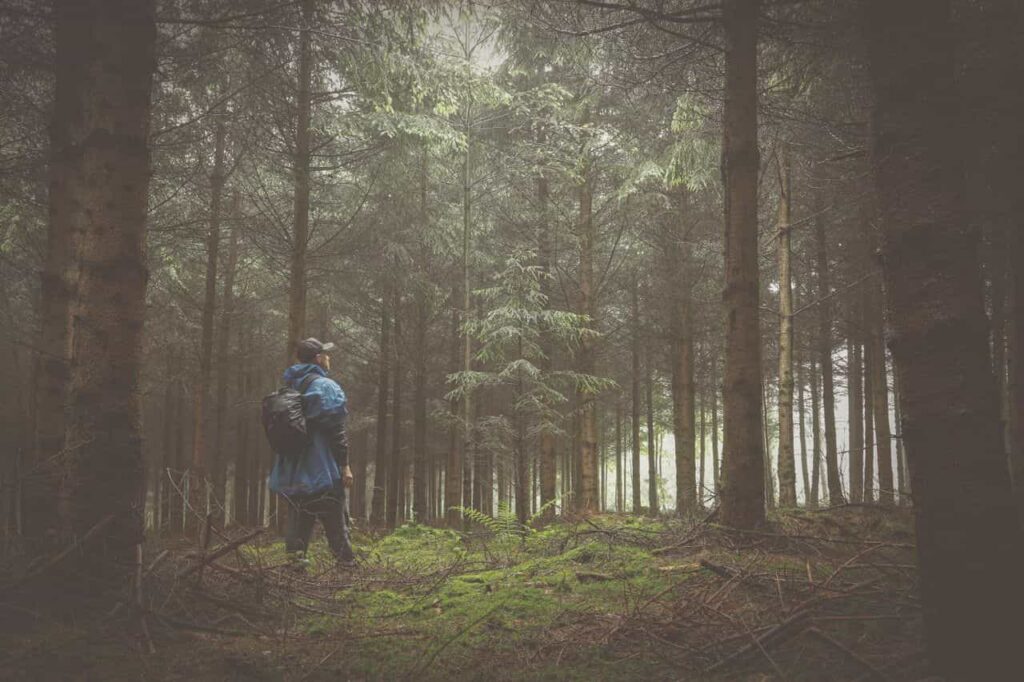
Intuitive trail finding is not an isolated skill you can turn on and off like a GPS setting. It works in concert with the whole gear system: the shoes that let you read the ground, the hydration practice that keeps your awareness clear, the layering that keeps your skin as a functioning sensor. A navigator who has lost touch with the terrain through the soles of their shoes, who is running on low water, who is cold and disoriented, is not in a position to practice dynamic harmony at a junction. The body must be capable of attending before the mind can attend.
Heel breathing and the art of sensory roaming are the foundation of this capability: when the foot is in contact with the ground, the nervous system receives information the screen can never replicate. The backcountry hydration philosophy sustains the clarity of awareness that the hippocampus needs to build a reliable mental map. The minimalist hiking gear philosophy of invisible design asks the same question the navigator eventually has to answer: how do you move through the landscape without the landscape being dominated by the tools you are carrying?
The Daoist approach is the same at every level: choose each element in relation to the whole. The shoe, the water bottle, the base layer, the compass sense, and none of them is sovereign. All of them are participants in the single act of moving through terrain with attention.
A Quick Reference for Your Next Junction
Before your next trip into unmarked or off-trail terrain, these four questions can serve as a mental checklist at any uncertain point on the route:
- What is the yang terrain and the yin terrain around me right now?
- Which direction is the water flowing, and where is the sound coming from?
- Which way is the wind coming from, and what does the tree canopy tell me about it?
- What anchor point did I just pass, and where is the next one I should be looking for?
If you can answer those four questions without consulting a screen, you are already navigating by the standard Lao Tzu set down in Chapter 28. You are knowing the white. You are keeping to the black.
A Note on Gear That Supports the Practice
Beyond GPS hiking, intuitive trail finding works best when the gear you are carrying gets out of the way of the practice rather than getting in the way of it. A heavy pack, a pair of shoes that isolate the foot from the ground, a phone that demands constant attention. These are obstacles to the kind of sustained sensory attention that the practice asks for.
Gear that moves with the body rather than against it is a quiet partner in the work of intuitive navigation. A base layer that manages the body’s thermal balance without demanding attention frees the mind to attend to the terrain rather than to the shirt. Footwear that restores the conversation between foot and ground is the most direct physical support for a practice that begins with the skin and ends with the mind.
The gear does not do the navigating for you. But the right gear makes the practice of navigating with your body something you can sustain all day long.